Software
Ocetrac
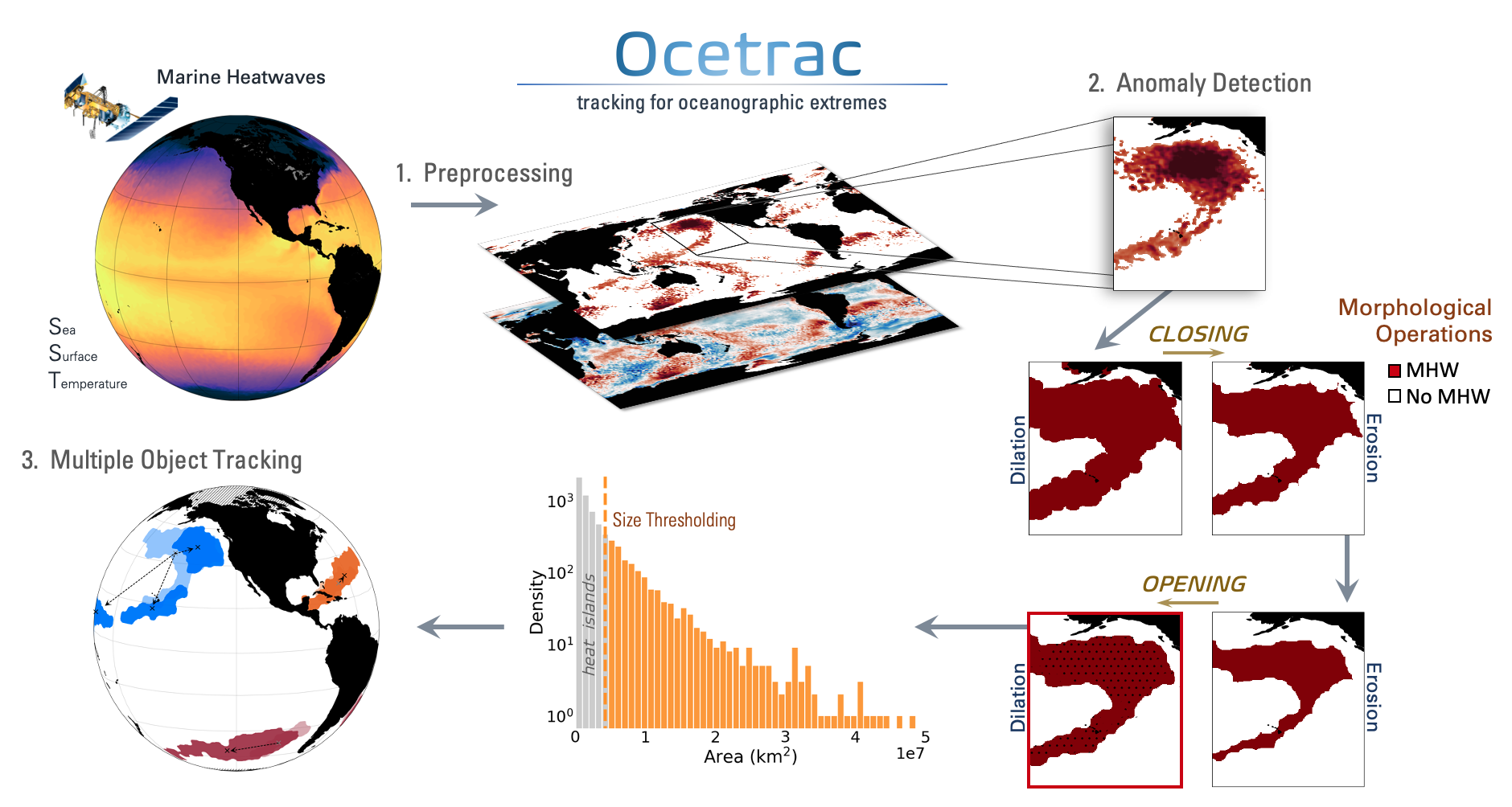
Ocetrac is a small python package that uses morphological image processing to label and track geophysical anomalies. It was developed as a tool to study the spatiotemporal evolution of marine heatwaves, which are extreme, persistant, and large-scale warming events at the sea surface.